Engineering Reports
| |

Cross Lake Dam, Spillway, and Intake Structure Study:
The purpose of this expansive study, was to examine four areas of concern on this project. These four areas involved the downstream side of the embankment, Cross Lake Dam, Spillway, and the Water treatment plant Intake Structure. The Study area for this project was limited to these aforementioned areas and their surrounding lands. Ultimately, this study was designed to research these four areas of concern, establish alternate solutions for the issues affecting the areas, and propose a potential course of action in a recommendation to the City of Shreveport. The recommendations were taken under advisement, so a possible future course of action for these areas of concern could be responsibly selected and acted upon for future projects. Some of the design alternatives that were called for and examined for the purposes of this report were a Longitudinal Stone Toe Protection installation, a Fluvial Geomorphological study, an Underwater Inspection, construction of a New Spillway, a new Fusegate System, an new Inflatable Weir System, Removal of Vegetation from Dam Embankment, a Mobile Limpet Cofferdam, and the construction of a New Intake Crib with a new Cylinder Screen System. One of the design solutions proposed in the study that was a dam clearing project that the City retained this firm to undertake, which was completed in 2015.
Caddo Parish Drainage Study:
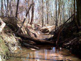
This report contains information compiled for a Drainage Study of part of the Subdivision "A Quiet Place in the Woods" which is located in Keithville, Caddo Parish, Louisiana. This report was prepared for the Caddo Parish Commission Department of Public Works. This project is over an area of approximately 38 acres crossing through several units of the previously mentioned Subdivision, more specifically Units 2-4. The primary data that was utilized for this report was collected through field survey work of the surrounding area. Additionally resources from the Federal Emergency Management Agency (FEMA), along with Topographic maps of the area produced by the Caddo Parish Commission, and State Quarter section maps were also used in compiling this report. This Study area was established arbitrarily in order to provide a wide enough area for the study, as well as include portions of the drainage ditch that is running along the Southern line of Unit Number 3. The results showed surface elevations indicated there were several low lying areas in and around the Subdivision. Thus the type of intense rainfall that was examined in the Study will cause temporary flooding within the nearby area. Therefore the Study showed that due to the conditions of the existing ditch, low lying surrounding areas, and the fact that portions lie in a Flood Zone flooding will occur within the Study Area during heavy rainfall.


 FEMA Flood Elevation Certificates

